
Lake Huron's Georgian Bay
July 2015
I was in awe. We had just anchored La Tasse in 15' of
Georgian Bay water. It was mid-afternoon
in early July, sunny and a comfortable 68 degrees. We were pretty much alone in the quiet
anchorage on the northern tip of the Bruce Peninsula, at Cabot Head. The views around us were breath-taking. We had been seeing these huge, partially
wooded, rock formations since leaving Tobermory on the northern tip of the
Bruce Peninsula a few hours earlier. But
in this anchorage, surrounded by land as we were, these formations, several miles long and wide
at the top and rising several hundred feet off the Georgian Bay water surface,
were somehow even more spectacular. We'd
been exploring the five Great Lakes by boat for more than a decade, traveling
more than 5,000 nm in the process and had never seen anything quite like it.

This trip, which began in
mid-June from our homeport of Manitowoc, WI, was to take us to the Georgian
Bay, the "last" (for us, at least) unexplored large body of water on
the Great Lakes. We crossed Lake
Michigan on June 16th and worked our way up and around Michigan's lower
peninsula leaving Presque Isle, MI for Tobermory, Ontario on June 28. We made the 80nm trip across Lake Huron in
just 11 1/2 hours benefiting most of the way from a helpful northerly
breeze. Frankly, we'd never heard much about the Georgian Bay
from other sailors. When we did, they
were usually passing through, reporting on their way to, or from, the better known and
more frequently visited North Channel.
We certainly didn't hear about the magic of the Bruce Peninsula.
The Bruce, itself, is part
of the Niagara escarpment extending about 70 miles north and west from Owen
Sound, Ontario on the south to Tobermory at its northern tip. Generally speaking, the peninsula is 5-10
miles wide and "creates" the Georgian Bay by separating Lake Huron's
waters along a mostly north/south plane. Indeed, the only water access from
Lake Huron to the Georgian Bay is via the Main Channel at Tobermory. The
peninsula's larger towns are concentrated on the Bay side, generally at the
head of a long channel or sound. The
marinas at Tobermory, Lion's Head and Wiarton have adequate, even excellent,
dockage, are comfortable and very well staffed. We visited them all! The
anchorages at Cabot Head (Wingfield Basin), in and around Melville Sound and in
Colpoys Bay are protected, have good holding and beautiful scenery. What's not
to like? The peninsula's Lake Huron shore, to the west, is rugged and rocky for
almost its entire length. The natural harbors
that do exist are generally open to the south or west, exposed to the
prevailing winds.
The Georgian Bay is
sometimes referred to as the "sixth Great Lake." And, for good reason. With a surface of 5,800 square miles, roughly
150 miles long and 50 miles wide, it's nearly as large as Lake Ontario (7,300
square miles). The Bay accounts for
about one quarter of Lake Huron's surface area. And, its deep, particularly to the west and
near the Bruce Peninsula. At 600 feet,
the deepest water is to be found off the peninsula's northern coast and near to
shore. That said, our depth sounder was
regularly showing 250 feet along that entire coast and often the depths were unreadable.
The topography to the
east, along Ontario's mainland, is quite different. Here one finds the Canadian Shield with its
very hard, generally flat and often exposed igneous rock. Much like the east
side of Lake Huron's North Channel, this coast is littered with typically
low-lying islands, big rocks, really.
Collectively, these are known as the "Thirty Thousand Islands"
and are part of Georgian Bay Islands National Park. They are, as you might guess, a haven for
gunk-holers!
We know, of course that
these islands were created by the glacial activity along the Canadian
Shield. But, science can be so
sterile! The Wyandot tell a much more
interesting story about their formation. The god Kitchikewna who lived along
the Bay's eastern shore as its guardian was a nice guy with a bad temper. When he was jilted by woman he hoped to marry,
he became quite incensed. Nothing new so
far... In an angry fit he went to the far end of Beausoleil Island, picked up a
large ball of earth and threw it into the Bay creating the islands. Smile but don't laugh. Giant's Tomb Island, where he still sleeps, is named for the guy!
The land along that
eastern shore is quite barren with few towns and little industry. The topsoil
that might have existed was long ago carried away by the ice sheets that
covered the area and then, some 10,000 years ago, melted. Towns and industry are more common along the Bay's
south shore (Wasaga Beach, Pennetanguishene and Midland) where all benefit from
their close proximity to Toronto, just 100 miles to the south along a good
highway.
Historical Significance.
Our understanding of early
humans in the area is largely from the French, although modern-day archaeological
digs have added meaningful information about the "early" periods. We
know, of course, that Europeans had ventured to the Grand Banks, Newfoundland
and the Gulf of St Lawrence long before Columbus "discovered" the
continent. Cartier recognized that fact
in his written accounts as early as 1534.
Champlain enters the picture in 1603, staying mostly along the coast. In 1608, he traveled up the St Lawrence and
established a settlement at what is today Quebec City. In 1610, after contact with Native Americans
from the interior, he sent Etienne Brule up the Ottawa River with Algonquin
traders. Brule's orders were to explore
the area and learn from the Natives. Brule's party most probably reached the
Georgian Bay via the Ottawa, Mattawa and French Rivers, a long traveled Native
route. In all likelihood, Etienne Brule,
less than 20 years old at the time, was the first European to actually see and
explore the Great Lakes. But he failed to record his "discovery!" Even
if he had, it's unlikely that his master would have allowed publication. That honor, you see, went to Champlain who visited the area for the first
time in 1615 using the same water route.
Once in the Georgian Bay, Champlain headed south. At the south end of the Bay and north of Lake
Ontario's western end, in the presence of the First Nations people living
there, he attended Mass (celebrated by Joseph Le Caron, a Recollect Friar
imported from France by Champlain himself some months earlier).
That trip, though, was about
more than sightseeing and attending Mass.
Recall that in 1609 Champlain had accompanied a band of Huron south from
what is now Montreal, up the Richelieu River and into Lake Champlain (neither
were called that then...) to confront the Iroquois. In a battle on July 30,
Champlain and one of his men killed three Iroquois chiefs. That accomplished, and with the boom of
Champlain's arquebus still ringing in their ears, the other two hundred fled. Is it any wonder why the Iroquois hated the
French for the next 100 years?
Fast forward six years.
After attending Mass on
August 12, 1615, Champlain toured Huronia including Lake Simcoe. He then set out on September 1 with ten Frenchmen
and about 300 Huron for yet another meeting with the Iroquois. They passed Lake Ontario's eastern end and
then headed south on foot into upstate New York. Their raid was a disaster. By October 16,
they were on their way back to Hurona with Champlain still nursing wounds from
the arrows that somehow found his leg.
The rest of the story for
the Native population living in this part of the Great Lakes region is all too familiar. Contact with Europeans led to disease,
alcoholism, and an ever increasing reliance on "trade goods." The ongoing war with the Iroquois only made
matters worse, ultimately forcing many of the Algonquin north. Tradition has it
that, while fleeing from the advancing Iroquois, the Algonquin actually burned
Manitoulin Island as they left in about 1650.
From 1650 until the 1800s there is little recorded history from the
area. Many historians think it was sparsely populated, at least in comparison
with the earlier years. The French and
their Algonquin allies, of course, continued to use the Ottawa River route for
the fur trade during that period. But, generally speaking, after the mid 1600s,
upon reaching the Georgian Bay, they went north to Lakes Michigan and Superior
or south along the same route back to Montreal and Quebec City.
Broken Promises.
The British took control
of Upper Canada in 1763 at the conclusion of the French and Indian War. From the outset, they saw the Native
population as a problem. Attempts at "civilization"
and "protection"
became, in reality, a series of broken promises as European immigrants rushed
to settle "unclaimed" lands without regard to Indian or First Nation
rights. The Bond Head Treaty in 1836,
which established Manitoulin Island as Ontario's "reservation," also simultaneously
extracted 1.5 million acres of Huron land south and east of the Bruce Peninsula. In return, the remaining Saugeen Ojibwa who
lived there, were relocated north to the poor soil of the Bruce Peninsula where,
the Crown promised to "... forever
protect you from the encroachments of the whites."
So much for that
promise. Five years before, in 1831, while
sailing north from Goderich, Alexander MacGregor "discovered" that
the islands adjacent to Oliphant on the peninsula's Lake Huron coast were
teeming with fish. (To this day, they
are called the Fishing or Pishing Islands). About the time the Bond Head Treaty
was signed, MacGregor was building a stone building on Main Station Island to
support his natural resource "development" activities. Not only was there an absence of interference from the Crown at the time, but
in about 1840, after involving itself in a commercial dispute, the Crown granted the exclusive right to such
fishing to a competitor of MacGregor! By
1854, the pressure from white settlers for lumber and fish became so great
that, with few exceptions, the entire peninsula was ceded to the Crown.
The evicted residents were to receive, in payment, the interest earned
by the Crown on the sale of these lands.
How do you suppose that worked out?
To help make clear my
point about attitude, consider the following.
In this writing, I have consistently referred to the peninsula as
"the Bruce Peninsula." I use
that name because the peninsula is today the northern end of Bruce county. The
county was named, in 1849, for James Bruce, who was then the Governor General
of British North America. After the 1836
Bond Treaty, when the Natives were evicted to the north, the peninsula was
commonly referred to as the "Saugeen" or "Indian"
peninsula. It was, after all, their
land. With the Treaty of 1854 there was no longer need for a separate name.
Particularly one that might suggest yet another broken promise!
With the Crown and the
white Europeans now fully in charge, the peninsula became a wasteland within 75
years. The lumber was clear cut and the
brush left behind became fuel for
widespread and intense fires. With little topsoil on this spit of the
Niagara escarpment to begin with, the burned land supported little commercial
vegetation. Making matters worse, the waste from commercial fishing operations during
those years was both sad and, in retrospect, sickening. Tons of fish that were netted but could not
be processed or sold, were left to rot on the shore. By the end of the 19th
century, commercial fishing was in significant decline. Then, in 1932, when the lamprey eel made its
appearance in the Great Lakes, commercial fishing essentially ceased.
Hope for the future.
Human beings do
learn. Tragically, the learning often comes
after a disaster so significant that even the hard core cannot ignore it. Such was apparently the case with the
Georgian Bay region. Despite the damage
done by natural resource exploitation, the natural beauty of the place would
eventually sink in. By the 1930s, people
from Ontario were beginning to buy plots and build cottages along the south
shore and among the islands. In 1929,
the Canadian government established the Georgian Bay Islands National Park by acquiring
63 islands near Port Severn with Beausoleil
Island being the largest. Included in
this acquisition was Flowerpot Island on the northern end of the Bay just a
short ferry trip from Tobermory. By the
1970s, Ontario had established a number of Provincial parks on the Bruce
peninsula including Fathom Five (the
islands and Bay waters to the north and east of Tobermory). The crowning achievement, I suppose, came in
1987 when, after nearly a decade of citizen involvement, Parks Canada announced
the creation of Bruce Peninsula National Park and the assumption as a national
park of Fathom Five (now incorporating Flowerpot Island). Taken
together, these National parks encompass more than 100 square miles of area on the northern end of the Bruce Peninsula.
The parks not only encourage tourists and their spending but they
preserve forever a significant portion of this special place on earth. Helping
draw people to the peninsula, the Chi-Cheemaun, a large ferry, carries about 80,000 vehicles
and 250,000 passengers each year between Tobermory and Manitoulin Island. It, and the highway bridge at Little Current,
provide the only commercial access to/fr Manitoulin.

Even the Native Americans seem
to be a getting a bit of a break recently. There can be no doubt that Native
peoples in both Canada and the United
States have been more aggressively asserting their Treaty rights since about
1950. Frequently, their legal complaints are about water, hunting and fishing;
their rights to harvest and use natural resources. Often these disputes arise
because there is conflict with, or complaints from, non-Native sporting
interests. This has certainly been the case in the Georgian Bay in general and
on the Bruce Peninsula specifically.
After decades of conflict
over fishing rights with the Ontario Ministry of Natural Resources (MNR) and its
allies, sportsmen from the Provence, an Ontario Court judge, David A.
Fairgrave, dismissed charges against two members of the Chippewas of Nawash
First Nations (the Ojibwa on Cape Croker). They had been charged for taking
more lake trout than permitted by the bands commercial fishing license. The practical effect of this 1993 ruling,
following the principles of the earlier 1990 Sparrow decision, gave the Ojibwa
First Nations priority access to both commercial and sport fishing in Georgian
Bay after conservation needs are met.
The decision led to some violence on the peninsula and left many issues
unresolved but the die, it seems, has been cast.
For good reason, the tourists keep coming.
While in Tobermory in
early and mid-July, the place was teeming with tourists. It was a mixed blessing. The town was alive, of course. The shops, restaurants
and bars were doing a steady business.
But our berth alongside one of two long docks that provide space for
transient boaters was a busy place adjacent as it was to the town's boat
ramp. For a time, we nervously kept
watch as the rented kayaks with predominately inexperienced pilots slid past
our hull. Thankfully most, but not all,
missed us. That angst was easily offset,
though, by the courteous and friendly transient boaters who shared the dock
with us. The marina facilities were close to the docks and quite adequate. The
staff at the marina in Little Tug Harbor was outstanding.

Lion's Head, we
discovered, is a very special place. The
views of the Lion's Head Promontory from the harbor are breathtaking. The town itself is quite charming with shops
and restaurants easily accessible to the marina. The sand beach and park at the
head of the harbor just add to natural charm of the place. While we were docked in the harbor we enjoyed
visiting the Farmers Market then a picnic
on the lawn listening to live music in the park. While the liquor store (LCBO) was a bit of a
trek out of town ( a 30 minute walk), we needed the exercise and got to enjoy
seeing fields of canola in full bloom! The marina was surprisingly large, with four
main docks and room more than 200 boats.
The facilities were quite good and, once again, the staff was excellent.
Ted, the Harbor Master, teased, asking
that we not tell too many boaters about our experience in Lion's Head for fear
that more activity would ruin the place!

Wiarton, at the head of
Colpoys Bay, is more commercial than
either Tobermory or Lion's Head and the marina is more of a "boat
yard." That's not meant to be
negative, however. The marina facilities
are charming with a large and comfortable boaters lounge built into an
existing two story frame building. It even has a wood burning fireplace! The
marina has a hoist (not so in either Tobermory or Lion's Head)and a friendly,
competent service department. We had La
Tasse "pulled" for a repair while in Wiarton and though it was a
stressful experience for us the staff eased our concerns by demonstrating early
that they knew what they were doing, cared about our boat and wanted to get us
back in the water as quickly as possible.
One can't ask for more than that when you are 700 nm from home.
Wiarton has less of a tourist
feel than either Tobermory or Lion's Head.
The restaurants serve more of the local trade. There's no Lion's Head Inn or Tobermory
Brewing Company, if you get my drift.
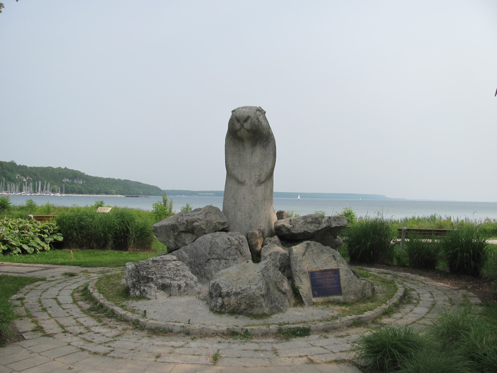
But Wiarton has one thing neither has; Wiarton Willy. Willy is an albino groundhog. His job, and that of his many predecessors,
has been to forecast an either late or early spring for Ontario by making a much
publicized visit each February. It's a
serious business. Willy's
"home" adjacent to the City buildings and the Visitor's Center is a
product of the Toronto zoo. His
longstanding significance to the city is literally "etched in stone"
as an 8 foot tall sculpture facing the
harbor!
Colpoys Bay, with Wiarton
at its head, is a charming place in its
own right. Sail boaters dot the water
daily. And why not? Three beautiful islands (Hay, White Cloud and Griffith) are
positioned at the northeast end of the Bay.
Each has lovely anchorages to enjoy, regardless of the wind direction. A short distance to the north and west of Colpoys
Bay is Melville Sound and Cape Croker.
We anchored in MacGregor Harbor at the east end of the Sound but suspect
one could spend a week anchoring in Melville Sound without spending two nights
in the same place.
North to Killarney and Home.
We took leave of the Bruce
Peninsula on July 13th and headed north, northeast past Flowerpot and Bear's
Rump Islands. The 43 nm trip to
Killarney would take us just a bit over 6 hours. We made good time, of course, but alas, once
again it was with the help of the iron jenny. The southerly breeze that day
helped but did not propel!
As we approached the
northeastern coast of the Georgian Bay, we traveled between Club and Lonely
Islands, later leaving Squaw Island off our starboard. During the trip, the eastern coast of
Manitoulin Island was almost always in view.
The change in scenery was obvious as we rounded Jackman Rock at Red Rock
Point and headed up the channel to the docks in town.
This was our first visit
to Killarney. We wish we had come to
this charming place sooner. Killarney is
a place of conflicts in many ways. The
town, built on the mainland coast across from George Island, is quite
small. The reported population of 400
seems inflated. Provisioning services
for boaters are limited which seems strange in a place that relied on only
water transport until the 1960s. On the
other hand, they have two fine, and rather large resorts; the Sportsman's Inn
and Killarney Mountain Lodge. Both have
dockage and the typical marina services.
The Sportsman's Inn offers white tablecloth dining and a spa! (We chose the resorts' adjacent pub and loved
it.) At the Killarney Mountain Lodge,
fine dining is also an option though the setting is more rustic. They have a great bar and, most nights, Andy
Lowe entertains a standing-room only crowd.
The setting and scenery were very "North Channel."

The 27 nm trip south and
then west to Little Current past Badegley, Centre and Partridge Island was made
on a calm and comfortable summer day. The sun was shining and the scenery
outstanding. So, we lolly-gagged and
almost missed the noon bridge opening.
But, by 12:30 pm we were docked and settled in Little Current. Shortly after, the wind began to blow and the
current in the channel began to demonstrate why this place should not be called
"Little Current!"
Our trip back to Manitowoc
was uneventful but for the blustery days in Mackinaw City and the day of severe
thunderstorms and strong wind in Leland, MI.
Nothing new here... But our
memories of the Bruce Peninsula and the beautiful blue waters of the Georgian
Bay traveled with us. And will always.

Lake Huron's Georgian Bay
July 2015
I was in awe. We had just anchored La Tasse in 15' of
Georgian Bay water. It was mid-afternoon
in early July, sunny and a comfortable 68 degrees. We were pretty much alone in the quiet
anchorage on the northern tip of the Bruce Peninsula, at Cabot Head. The views around us were breath-taking. We had been seeing these huge, partially
wooded, rock formations since leaving Tobermory on the northern tip of the
Bruce Peninsula a few hours earlier. But
in this anchorage, surrounded by land as we were, these formations, several miles long and wide
at the top and rising several hundred feet off the Georgian Bay water surface,
were somehow even more spectaular. We'd
been exploring the five Great Lakes by boat for more than a decade, traveling
more than 5,000 nm in the process and had never seen anything quite like it.
This trip, which began in
mid-June from our homeport of Manitowoc, WI, was to take us to the Georgian
Bay, the "last" (for us, at least) unexplored large body of water on
the Great Lakes. We crossed Lake
Michigan on June 16th and worked our way up and around Michigan's lower
peninsula leaving Presque Isle, MI for Tobermory, Ontario on June 28. We made the 80nm trip across Lake Huron in
just 11 1/2 hours benefiting most of the way from a helpful northerly
breeze. Frankly, we'd never heard much about the Georgian Bay
from other sailors. When we did, they
were usually passing through, reporting on their way to, or from, the better known and
more frequently visited North Channel.
We certainly didn't hear about the magic of the Bruce Peninsula.
The Bruce, itself, is part
of the Niagara escarpment extending about 70 miles north and west from Owen
Sound, Ontario on the south to Tobermory at its northern tip. Generally speaking, the peninsula is 5-10
miles wide and "creates" the Georgian Bay by separating Lake Huron's
waters along a mostly north/south plane. Indeed, the only water access from
Lake Huron to the Georgian Bay is via the Main Channel at Tobermory. The
peninsula's larger towns are concentrated on the Bay side, generally at the
head of a long channel or sound. The
marinas at Tobermory, Lion's Head and Wiarton have adequate, even excellent,
dockage, are comfortable and very well staffed. We visited them all! The
anchorages at Cabot Head (Wingfield Basin), in and around Melville Sound and in
Colpoys Bay are protected, have good holding and beautiful scenery. What's not
to like? The peninsula's Lake Huron shore, to the west, is rugged and rocky for
almost its entire length. The natural harbors
that do exist are generally open to the south or west, exposed to the
prevailing winds.
The Georgian Bay is
sometimes referred to as the "sixth Great Lake." And, for good reason. With a surface of 5,800 square miles, roughly
150 miles long and 50 miles wide, it's nearly as large as Lake Ontario (7,300
square miles). The Bay accounts for
about one quarter of Lake Huron's surface area. And, its deep, particularly to the west and
near the Bruce Peninsula. At 600 feet,
the deepest water is to be found off the peninsula's northern coast and near to
shore. That said, our depth sounder was
regularly showing 250 feet along that entire coast and often the depths were unreadable.
The topography to the
east, along Ontario's mainland, is quite different. Here one finds the Canadian Shield with its
very hard, generally flat and often exposed igneous rock. Much like the east
side of Lake Huron's North Channel, this coast is littered with typically
low-lying islands, big rocks, really.
Collectively, these are known as the "Thirty Thousand Islands"
and are part of Georgian Bay Islands National Park. They are, as you might guess, a haven for
gunk-holers!
We know, of course that
these islands were created by the glacial activity along the Canadian
Shield. But, science can be so
sterile! The Wyandot tell a much more
interesting story about their formation. The god Kitchikewna who lived along
the Bay's eastern shore as its guardian was a nice guy with a bad temper. When he was jilted by woman he hoped to marry,
he became quite incensed. Nothing new so
far... In an angry fit he went to the far end of Beausoleil Island, picked up a
large ball of earth and threw it into the Bay creating the islands. Smile but don't laugh. Giant's Tomb Island, where he still sleeps, is named for the guy!
The land along that
eastern shore is quite barren with few towns and little industry. The topsoil
that might have existed was long ago carried away by the ice sheets that
covered the area and then, some 10,000 years ago, melted. Towns and industry are more common along the Bay's
south shore (Wasaga Beach, Pennetanguishene and Midland) where all benefit from
their close proximity to Toronto, just 100 miles to the south along a good
highway.
Historical Significance.
Our understanding of early
humans in the area is largely from the French, although modern-day archeological
digs have added meaningful information about the "early" periods. We
know, of course, that Europeans had ventured to the Grand Banks, Newfoundland
and the Gulf of St Lawrence long before Columbus "discovered" the
continent. Cartier recognized that fact
in his written accounts as early as 1534.
Champlain enters the picture in 1603, staying mostly along the coast. In 1608, he traveled up the St Lawrence and
established a settlement at what is today Quebec City. In 1610, after contact with Native Americans
from the interior, he sent Etienne Brule up the Ottawa River with Algonquin
traders. Brule's orders were to explore
the area and learn from the Natives. Brule's party most probably reached the
Georgian Bay via the Ottawa, Mattawa and French Rivers, a long traveled Native
route. In all likelihood, Etienne Brule,
less than 20 years old at the time, was the first European to actually see and
explore the Great Lakes. But he failed to record his "discovery!" Even
if he had, it's unlikely that his master would have allowed publication. That honor, you see, went to Champlain who visited the area for the first
time in 1615 using the same water route.
Once in the Georgian Bay, Champlain headed south. At the south end of the Bay and north of Lake
Ontario's western end, in the presence of the First Nations people living
there, he attended Mass (celebrated by Joseph Le Caron, a Recollect Friar
imported from France by Champlain himself some months earlier).
That trip, though, was about
more than sightseeing and attending Mass.
Recall that in 1609 Champlain had accompanied a band of Huron south from
what is now Montreal, up the Richelieu River and into Lake Champlain (neither
were called that then...) to confront the Iroquois. In a battle on July 30,
Champlain and one of his men killed three Iroquois chiefs. That accomplished, and with the boom of
Champlain's arquebus still ringing in their ears, the other two hundred fled. Is it any wonder why the Iroquois hated the
French for the next 100 years?
Fast forward six years.
After attending Mass on
August 12, 1615, Champlain toured Huronia including Lake Simcoe. He then set out on September 1 with ten Frenchmen
and about 300 Huron for yet another meeting with the Iroquois. They passed Lake Ontario's eastern end and
then headed south on foot into upstate New York. Their raid was a disaster. By October 16,
they were on their way back to Hurona with Champlain still nursing wounds from
the arrows that somehow found his leg.
The rest of the story for
the Native population living in this part of the Great Lakes region is all too familiar. Contact with Europeans led to disease,
alcoholism, and an ever increasing reliance on "trade goods." The ongoing war with the Iroquois only made
matters worse, ultimately forcing many of the Algonquin north. Tradition has it
that, while fleeing from the advancing Iroquois, the Algonquin actually burned
Manitoulin Island as they left in about 1650.
From 1650 until the 1800s there is little recorded history from the
area. Many historians think it was sparsely populated, at least in comparison
with the earlier years. The French and
their Algonquin allies, of course, continued to use the Ottawa River route for
the fur trade during that period. But, generally speaking, after the mid 1600s,
upon reaching the Georgian Bay, they went north to Lakes Michigan and Superior
or south along the same route back to Montreal and Quebec City.
Broken Promises.
The British took control
of Upper Canada in 1763 at the conclusion of the French and Indian War. From the outset, they saw the Native
population as a problem. Attempts at "civilization"
and "protection"
became, in reality, a series of broken promises as European immigrants rushed
to settle "unclaimed" lands without regard to Indian or First Nation
rights. The Bond Head Treaty in 1836,
which established Manitoulin Island as Ontario's "reservation," also simultaneously
extracted 1.5 million acres of Huron land south and east of the Bruce Peninsula. In return, the remaining Saugeen Ojibwa who
lived there, were relocated north to the poor soil of the Bruce Peninsula where,
the Crown promised to "... forever
protect you from the encroachments of the whites."
So much for that
promise. Five years before, in 1831, while
sailing north from Goderich, Alexander MacGregor "discovered" that
the islands adjacent to Oliphant on the peninsula's Lake Huron coast were
teeming with fish. (To this day, they
are called the Fishing or Pishing Islands). About the time the Bond Head Treaty
was signed, MacGregor was building a stone building on Main Station Island to
support his natural resource "development" activities. Not only was there an absence of interference from the Crown at the time, but
in about 1840, after involving itself in a commercial dispute, the Crown granted the exclusive right to such
fishing to a competitor of MacGregor! By
1854, the pressure from white settlers for lumber and fish became so great
that, with few exceptions, the entire peninsula was ceded to the Crown.
The evicted residents were to receive, in payment, the interest earned
by the Crown on the sale of these lands.
How do you suppose that worked out?
To help make clear my
point about attitude, consider the following.
In this writing, I have consistently referred to the peninsula as
"the Bruce Peninsula." I use
that name because the peninsula is today the northern end of Bruce county. The
county was named, in 1849, for James Bruce, who was then the Governor General
of British North America. After the 1836
Bond Treaty, when the Natives were evicted to the north, the peninsula was
commonly referred to as the "Saugeen" or "Indian"
peninsula. It was, after all, their
land. With the Treaty of 1854 there was no longer need for a separate name.
Particularly one that might suggest yet another broken promise!
With the Crown and the
white Europeans now fully in charge, the peninsula became a wasteland within 75
years. The lumber was clear cut and the
brush left behind became fuel for
widespread and intense fires. With little topsoil on this spit of the
Niagara escarpment to begin with, the burned land supported little commercial
vegetation. Making matters worse, the waste from commercial fishing operations during
those years was both sad and, in retrospect, sickening. Tons of fish that were netted but could not
be processed or sold, were left to rot on the shore. By the end of the 19th
century, commercial fishing was in significant decline. Then, in 1932, when the lamprey eel made its
appearance in the Great Lakes, commercial fishing essentially ceased.
Hope for the future.
Human beings do
learn. Tragically, the learning often comes
after a disaster so significant that even the hard core cannot ignore it. Such was apparently the case with the
Georgian Bay region. Despite the damage
done by natural resource exploitation, the natural beauty of the place would
eventually sink in. By the 1930s, people
from Ontario were beginning to buy plots and build cottages along the south
shore and among the islands. In 1929,
the Canadian government established the Georgian Bay Islands National Park by acquiring
63 islands near Port Severn with Beausoleil
Island being the largest. Included in
this acquisition was Flowerpot Island on the northern end of the Bay just a
short ferry trip from Tobermory. By the
1970s, Ontario had established a number of Provincial parks on the Bruce
peninsula including Fathom Five (the
islands and Bay waters to the north and east of Tobermory). The crowning achievement, I suppose, came in
1987 when, after nearly a decade of citizen involvement, Parks Canada announced
the creation of Bruce Peninsula National Park and the assumption as a national
park of Fathom Five (now incorporating Flowerpot Island). Taken
together, these National parks encompass more than 100 square miles of area on the northern end of the Bruce Peninsula.
The parks not only encourage tourists and their spending but they
preserve forever a significant portion of this special place on earth. Helping
draw people to the peninsula, the Chi-Cheemaun, a large ferry, carries about 80,000 vehicles
and 250,000 passengers each year between Tobermory and Manitoulin Island. It, and the highway bridge at Little Current,
provide the only commercial access to/fr Manitoulin.
Even the Native Americans seem
to be a getting a bit of a break recently. There can be no doubt that Native
peoples in both Canada and the United
States have been more aggressively asserting their Treaty rights since about
1950. Frequently, their legal complaints are about water, hunting and fishing;
their rights to harvest and use natural resources. Often these disputes arise
because there is conflict with, or complaints from, non-Native sporting
interests. This has certainly been the case in the Georgian Bay in general and
on the Bruce Peninsula specifically.
After decades of conflict
over fishing rights with the Ontario Ministry of Natural Resources (MNR) and its
allies, sportsmen from the Provence, an Ontario Court judge, David A.
Fairgrave, dismissed charges against two members of the Chippewas of Nawash
First Nations (the Ojibwa on Cape Croker). They had been charged for taking
more lake trout than permitted by the bands commercial fishing license. The practical effect of this 1993 ruling,
following the principles of the earlier 1990 Sparrow decision, gave the Ojibwa
First Nations priority access to both commercial and sport fishing in Georgian
Bay after conservation needs are met.
The decision led to some violence on the peninsula and left many issues
unresolved but the die, it seems, has been cast.
For good reason, the tourists keep coming.
While in Tobermory in
early and mid-July, the place was teeming with tourists. It was a mixed blessing. The town was alive, of course. The shops, restaurants
and bars were doing a steady business.
But our berth alongside one of two long docks that provide space for
transient boaters was a busy place adjacent as it was to the town's boat
ramp. For a time, we nervously kept
watch as the rented kayaks with predominately inexperienced pilots slid past
our hull. Thankfully most, but not all,
missed us. That angst was easily offset,
though, by the courteous and friendly transient boaters who shared the dock
with us. The marina facilities were close to the docks and quite adequate. The
staff at the marina in Little Tug Harbor was outstanding.
Lion's Head, we
discovered, is a very special place. The
views of the Lion's Head Promontory from the harbor are breathtaking. The town itself is quite charming with shops
and restaurants easily accessible to the marina. The sand beach and park at the
head of the harbor just add to natural charm of the place. While we were docked in the harbor we enjoyed
visiting the Farmers Market then a picnic
on the lawn listening to live music in the park. While the liquor store (LCBO) was a bit of a
trek out of town ( a 30 minute walk), we needed the exercise and got to enjoy
seeing fields of canola in full bloom! The marina was surprisingly large, with four
main docks and room more than 200 boats.
The facilities were quite good and, once again, the staff was excellent.
Ted, the Harbor Master, teased, asking
that we not tell too many boaters about our experience in Lion's Head for fear
that more activity would ruin the place!
Wiarton, at the head of
Colpoys Bay, is more commercial than
either Tobermory or Lion's Head and the marina is more of a "boat
yard." That's not meant to be
negative, however. The marina facilities
are charming with a large and comfortable boaters lounge built into an
existing two story frame building. It even has a wood burning fireplace! The
marina has a hoist (not so in either Tobermory or Lion's Head)and a friendly,
competent service department. We had La
Tasse "pulled" for a repair while in Wiarton and though it was a
stressful experience for us the staff eased our concerns by demonstrating early
that they knew what they were doing, cared about our boat and wanted to get us
back in the water as quickly as possible.
One can't ask for more than that when you are 700 nm from home.
Wiarton has less of a tourist
feel than either Tobermory or Lion's Head.
The restaurants serve more of the local trade. There's no Lion's Head Inn or Tobermory
Brewing Company, if you get my drift.
But Wiarton has one thing neither has; Wiarton Willy. Willy is an albino groundhog. His job, and that of his many predecessors,
has been to forecast an either late or early spring for Ontario by making a much
publicized visit each February. It's a
serious business. Willy's
"home" adjacent to the City buildings and the Visitor's Center is a
product of the Toronto zoo. His
longstanding significance to the city is literally "etched in stone"
as an 8 foot tall sculpture facing the
harbor!
Colpoys Bay, with Wiarton
at its head, is a charming place in its
own right. Sail boaters dot the water
daily. And why not? Three beautiful islands (Hay, White Cloud and Griffith) are
positioned at the northeast end of the Bay.
Each has lovely anchorages to enjoy, regardless of the wind direction. A short distance to the north and west of Colpoys
Bay is Melville Sound and Cape Croker.
We anchored in MacGregor Harbor at the east end of the Sound but suspect
one could spend a week anchoring in Melville Sound without spending two nights
in the same place.
North to Killarney and Home.
We took leave of the Bruce
Peninsula on July 13th and headed north, northeast past Flowerpot and Bear's
Rump Islands. The 43 nm trip to
Killarney would take us just a bit over 6 hours. We made good time, of course, but alas, once
again it was with the help of the iron jenny. The southerly breeze that day
helped but did not propel!
As we approached the
northeastern coast of the Georgian Bay, we traveled between Club and Lonely
Islands, later leaving Squaw Island off our starboard. During the trip, the eastern coast of
Manitoulin Island was almost always in view.
The change in scenery was obvious as we rounded Jackman Rock at Red Rock
Point and headed up the channel to the docks in town.
This was our first visit
to Killarney. We wish we had come to
this charming place sooner. Killarney is
a place of conflicts in many ways. The
town, built on the mainland coast across from George Island, is quite
small. The reported population of 400
seems inflated. Provisioning services
for boaters are limited which seems strange in a place that relied on only
water transport until the 1960s. On the
other hand, they have two fine, and rather large resorts; the Sportsman's Inn
and Killarney Mountain Lodge. Both have
dockage and the typical marina services.
The Sportsman's Inn offers white tablecloth dining and a spa! (We chose the resorts' adjacent pub and loved
it.) At the Killarney Mountain Lodge,
fine dining is also an option though the setting is more rustic. They have a great bar and, most nights, Andy
Lowe entertains a standing-room only crowd.
The setting and scenery were very "North Channel."
The 27 nm trip south and
then west to Little Current past Badegley, Centre and Partridge Island was made
on a calm and comfortable summer day. The sun was shining and the scenery
outstanding. So, we lolly-gagged and
almost missed the noon bridge opening.
But, by 12:30 pm we were docked and settled in Little Current. Shortly after, the wind began to blow and the
current in the channel began to demonstrate why this place should not be called
"Little Current!"
Our trip back to Manitowoc
was uneventful but for the blustery days in Mackinaw City and the day of severe
thunderstorms and strong wind in Leland, MI.
Nothing new here... But our
memories of the Bruce Peninsula and the beautiful blue waters of the Georgian
Bay traveled with us. And will always.
